Altitude: 776m to 1633m. Gain: 128m. Loss: 861m . Gradient: 39 deg (Moderate-hard)
Skills: Alpine weather (2/7) - Occasional rivers (3/6)
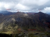
The ridge line of the Livingstone Mountains is broad and easy to follow so head northwards past Peak 1588 (sidle on scree on its eastern side) and follow the ridge line up to the base of Peak 1750. Peak 1750 makes a good side trip and is easily climbed from here. Drop northwards down steep scree and tussock into the valley draining the northern slopes of Peak 1750, and descend down on the true right avoiding numerous Spaniard bushes. Between 900-1000m cross the stream to the true left and descend down tussock slopes into the Windon Burn valley, Forks hut clearly visible on the other side of the river. Look for a crossing point , or make your way down to the 4WD ford and gain the 4WD track on the true left of the Windon Burn. Follow this up to Forks hut.